


Voting District 81, Mercer County, West Virginia
About
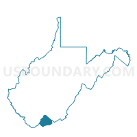
Outline

Summary
| Unique Area Identifier | 691358 |
| Name | Voting District 81 |
| County | Mercer County |
| State | West Virginia |
| Area (square miles) | 2.50 |
| Land Area (square miles) | 2.50 |
| Water Area (square miles) | 0.01 |
| % of Land Area | 99.75 |
| % of Water Area | 0.25 |
| Latitude of the Internal Point | 37.38895340 |
| Longtitude of the Internal Point | -81.10750170 |
Maps


Graphs
Select a template below for downloading or customizing gragh for Voting District 81, Mercer County, West Virginia


Neighbors
Neighoring Voting District (by Name) Neighboring Voting District on the Map
- Voting District 53, Mercer County, WV
- Voting District 54, Mercer County, WV
- Voting District 77, Mercer County, WV
- Voting District 78, Mercer County, WV
- Voting District 80, Mercer County, WV
- Voting District 82, Mercer County, WV
- Voting District 83, Mercer County, WV
- Voting District 84, Mercer County, WV
- Voting District 87, Mercer County, WV
- Voting District 95, Mercer County, WV
Top 10 Neighboring County Subdivision (by Population) Neighboring County Subdivision on the Map
Top 10 Neighboring Place (by Population) Neighboring Place on the Map
Top 10 Neighboring Unified School District (by Population) Neighboring Unified School District on the Map
Top 10 Neighboring State Legislative District Lower Chamber (by Population) Neighboring State Legislative District Lower Chamber on the Map
Top 10 Neighboring State Legislative District Upper Chamber (by Population) Neighboring State Legislative District Upper Chamber on the Map
Top 10 Neighboring 111th Congressional District (by Population) Neighboring 111th Congressional District on the Map
Top 10 Neighboring Census Tract (by Population) Neighboring Census Tract on the Map
- Census Tract 15, Mercer County, WV (5,446)
- Census Tract 10, Mercer County, WV (4,789)
- Census Tract 13, Mercer County, WV (3,751)
- Census Tract 12, Mercer County, WV (3,739)
- Census Tract 14, Mercer County, WV (1,979)